CONSULTANTS
The Go-To Source for Rail Data
Bring independent insights on the rail network to help your clients improve oversight, make informed plans, and enhance safety across their regions.
RailState for Consultants
Your clients need current rail data but are stuck with outdated datasets and unverified carrier reports. This limits your analyses and hampers your ability to deliver the strategic insights clients expect from top-tier consulting.
RailState provides real-time rail intelligence that empowers you to differentiate your practice and deliver superior analyses. Our current, independent data gives you the insights needed to help clients make stronger investments and solve complex transportation challenges.
Help Clients Make Stronger Investments
Major public project decisions should not be based on analyses using unverified carrier-supplied data or overly restrictive agreements on data access.
Give your client’s capital projects and public funding decisions the analyses they deserve using the best data available.
- Data-driven support for better project applications
- Independent validation of railroad-supplied information
- All train traffic data needed to accurately evaluate capacity
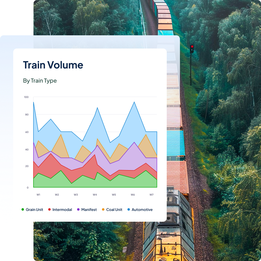
Differentiate Your Planning Practice
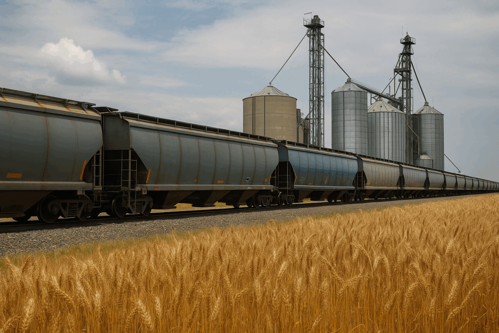
Everyone has relied on outdated datasets like the Carload Waybill Sample for freight and rail planning. Now there’s a new option to bring more accuracy and better data to your planning work.
Accelerate planning with comprehensive data on rail network performance and ensure you’re helping clients build reliable transportation networks for the future.
- Accurate measures of train, railcar, and container volumes
- Detailed commodity flows through specific corridors
- Models based on current real-world conditions, not assumptions
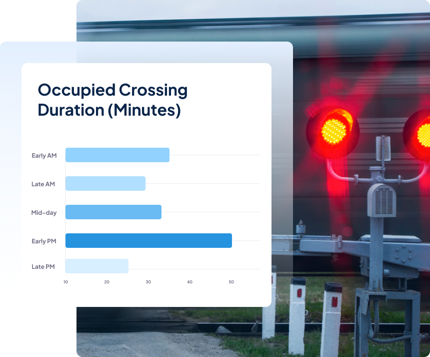
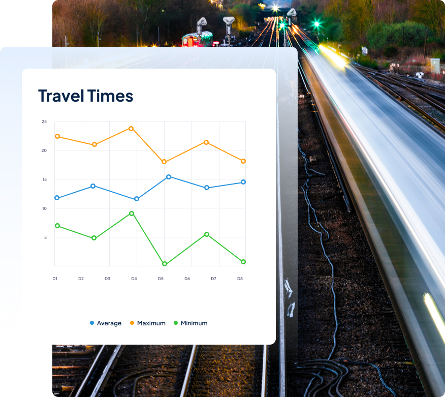
Deliver Blocked Crossing Solutions
Today’s longer trains are an increasing source of local pain — frustrating commuters, harming local economies, and increasing safety risks for residents.
Help your clients understand the true impact and prioritize fixes using the only network-aware solution for blocked crossing risk.
- Identify when and where long trains most frequently block crossings
- Quantify community impact with real numbers on the delays affecting commuters and emergency vehicles
- Instant alerts of incoming trains and advanced warnings for traffic rerouting
Why work with RailState?
Track Record
Our team has more than one hundred years of collective experience working in the rail industry. For more than 5 years we’ve provided federal, state, and provincial agencies across North America with access to the best source of rail network data, which is now based on more than 4.5 billion images of trains moving on the network.
Easily Integrated
We connect quickly into your existing tools and workflows. Either through an easy-to-use web interface accessible from any browser or direct connection through our API, which some experienced data analysts have described as “a dream to use.”
Fast Deployment
If we have coverage in your area, you can get data access right away. If we don’t have coverage in your area yet, we can be up and running fast. New sensors can be installed and providing you rail network data in less than 4 weeks.
Reliability
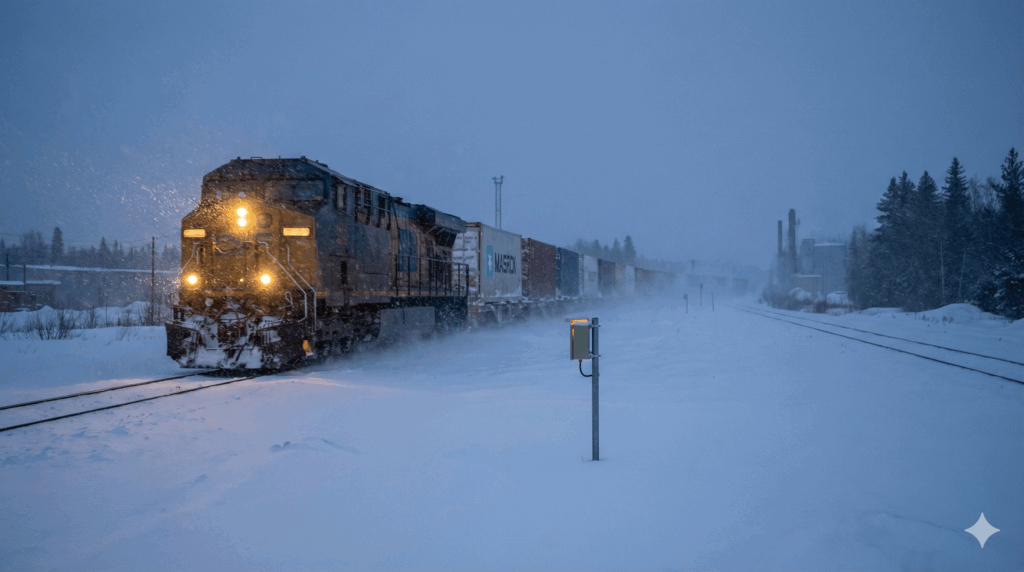
RailState sensors have been battle-tested in the field for years and consistently performing through all weather conditions, from driving snow and rain to temperatures as low as -45 degrees and as high as 120 degrees.
No Capital Expenditures
There are no equipment or maintenance costs working with RailState. All commercial agreements are subscriptions for data. We handle all equipment setup and maintenance work for our sensors.
Certified Small Business
RailState is a certified small business with corporate entities and teams in both the United States and Canada.
Our Coverage Area
Our network is already continent-wide. We have complete coverage across Canada, all major U.S.-Canada and U.S.-Mexico border crossings, and we’re rapidly expanding across the United States.
Check the map to see current and planned coverage.
- Blue: Up to 4 years of data history
- Green: Coming online within the next 90 days
Latest Insights
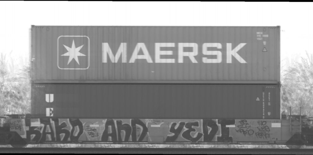
Maersk Moves to UP
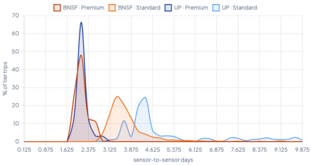
A Tale of Two Corridors
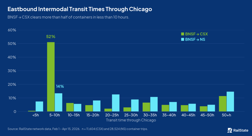
How Bad is the Rail Bottleneck in Chicago?
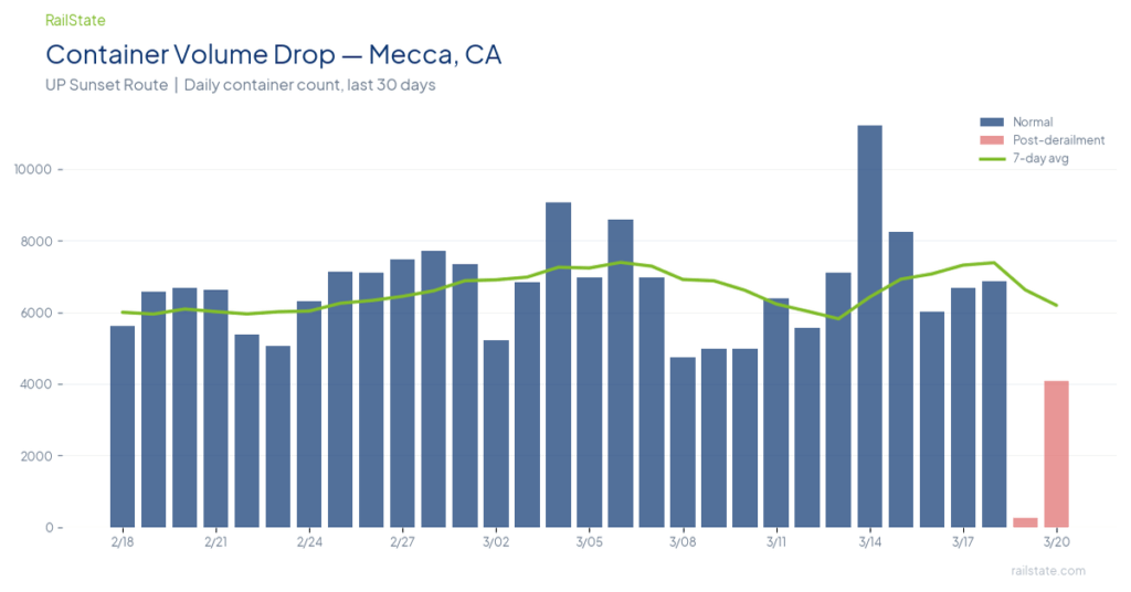
Two Derailments in 36 Hours Choke Major U.S. Freight Corridors
Winter Storm Fern: RailState Data Shows Network Impact Across Three States